What you see in Catchwise
All your key fishing data in one map – built for commercial fisheries.
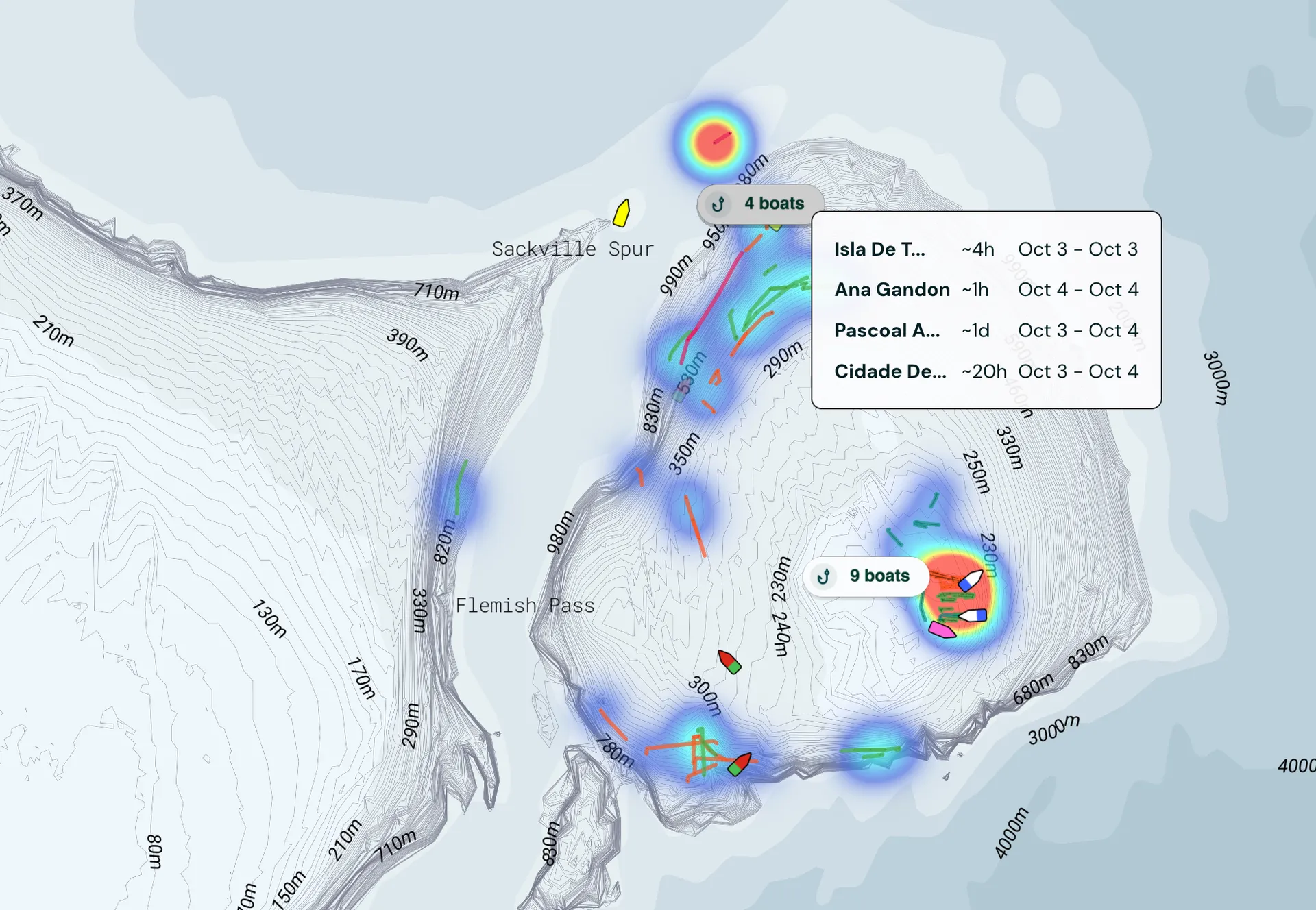
Never miss a fishing opportunity again
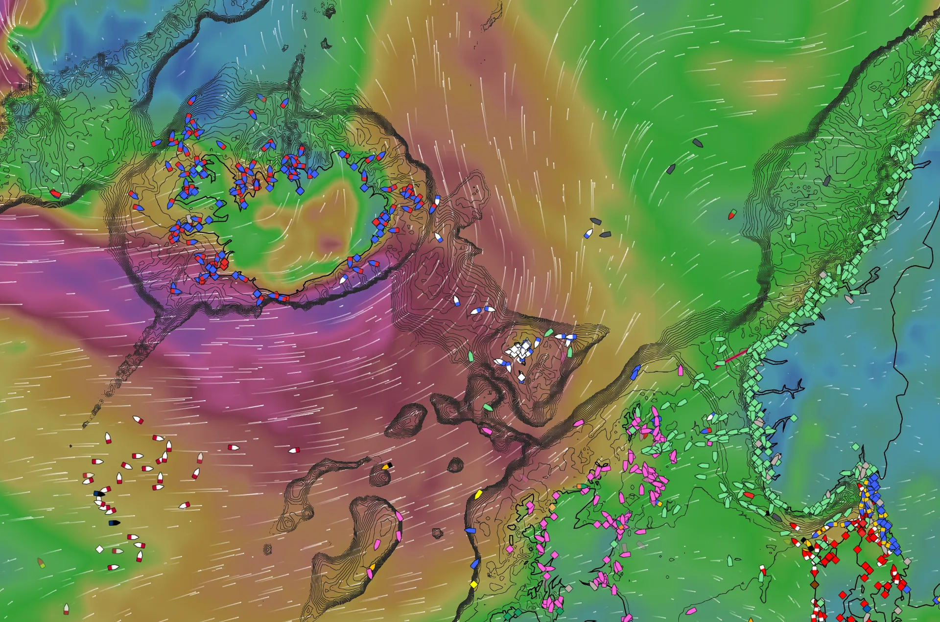
Premium AIS and tracking from multiple satellite networks
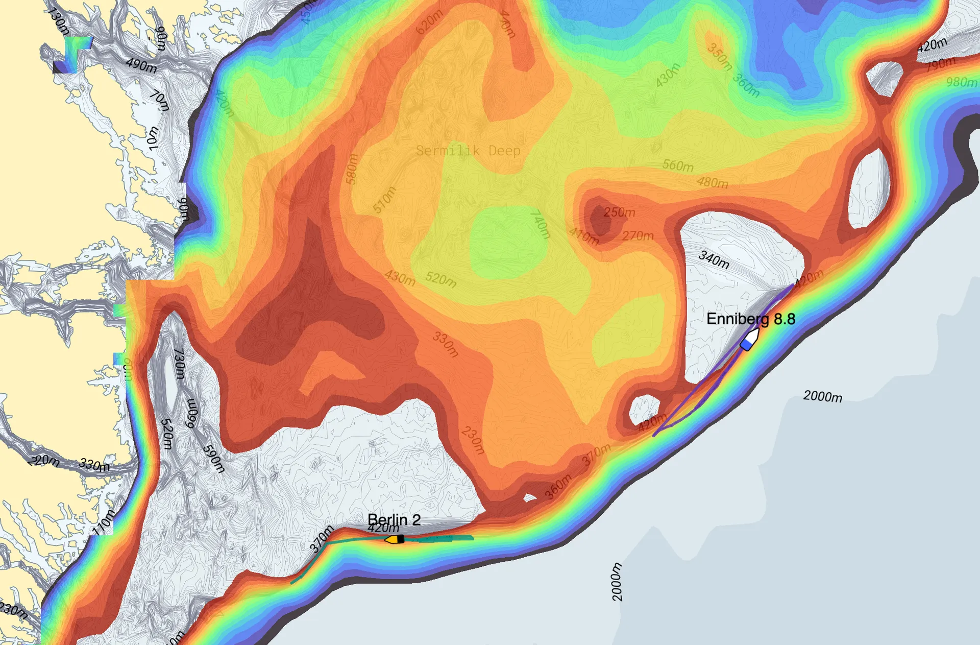
See hotspots where vessels have fished extensively.
See where good fishing has occurred in the past.
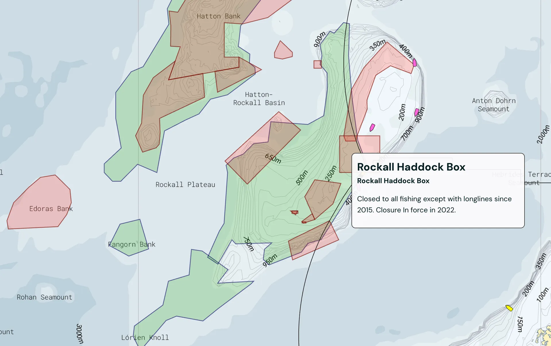
Avoid closed areas and fines
Search fishing regulations with AI.
Precise weather forecasts
See wind, waves and currents now and several days ahead.
Find temperature-sensitive species using bottom temperature data
Analyze ocean conditions where fish thrive using AI.
See bottom temperature, currents and zooplankton.
Find areas where the conditions are right for your target species and size.