July 13, 2026
Three Catchwise features skippers use every day
Some features in Catchwise are used again and again because they give skippers a better overview, both before and during the trip.See how skippers use the weather forecasts, haul detection and ocean conditions. With a 14-day free trial, you get access to all three.Written by
Ann Elinor Aasen
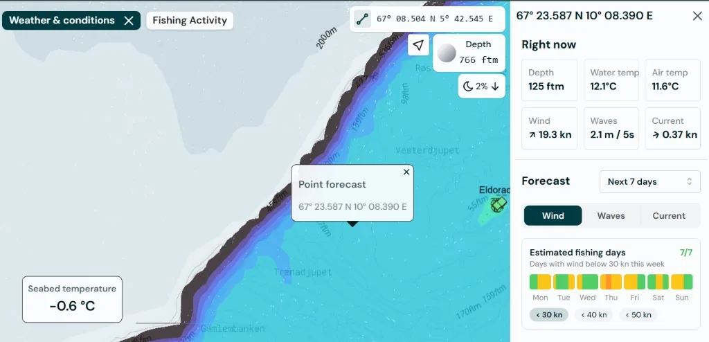
1. Weather: check conditions for the exact area you are considering
Reading the conditions is a key part of planning a fishing trip. Wind, waves, currents and temperature all affect the picture you build before deciding where to go.
In Catchwise, premium weather and ocean data are available directly in the map. You can right-click any spot and open a forecast panel for that exact location, instead of relying only on general forecasts for a larger area.
You can also compare different grounds side by side and see how conditions are expected to develop over hours and days.
Catchwise weather and conditions includes:
- Wind with gusts
- Waves
- Currents
- Surface and bottom temperature
- Depth
- Plankton
- Upwelling
- Ice charts
2. Fishing Activity: see where vessels have been active
Fishing Activity helps you see where vessels have had gear in the water.
Catchwise uses vessel movement patterns to identify likely fishing activity based on speed, course and position. This gives you a quick overview of active fishing grounds without having to manually follow every vessel or analyze tracks yourself.
You can use Fishing Activity to:
- See active fishing grounds directly on the map
- Search an area and find vessels that have been fishing there
- Go back in time and view historic fishing activity
- Spot trends in how activity is developing
- Get a better overview when changing grounds or coming back from leave
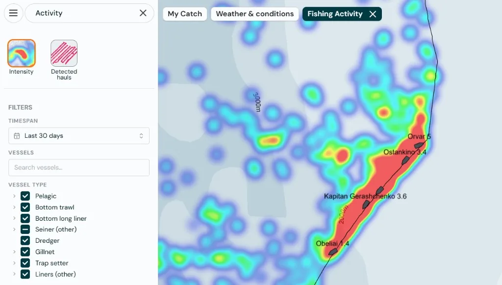
Fishing Activity gives you a fast overview and help understand what is happening in the areas you care about.
3. Bottom Temperature: find the right conditions
Bottom Temperature is part of Weather and Conditions in Catchwise. It shows the estimated seabed temperature in the areas you are looking at.
You can also use Target Mode to highlight areas with a specific bottom temperature.
This is useful because many species are sensitive to water temperature. With My Catch, you can look back at previous hauls and see which seabed temperatures have worked before, in which areas, seasons and for which species.
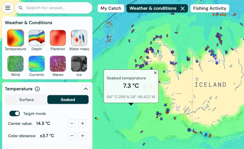
In selected regions, Catchwise also uses hyperlocal ocean models for more accurate local detail, especially near the coast, over banks and along steep slopes.
Try all three for free
With a 14-day free trial, you get access to Weather, Fishing Activity and Bottom Temperature in Catchwise.
We help you get set up, show you the most relevant features and make sure the trial is useful for your vessel and your fishery.
Start your free trial before your next trip and see what Catchwise can do in real planning.
Try Catchwise
Try Catchwise on your next trip. Click the button below to get started. No credit card required.